Northampton, Massachusetts used to be a hub of railroad activity back in the late 1800s and through most of the 1900s. A map of downtown Northampton 1895 shows the two big railroad companies that traveled through the city: The Boston & Maine Railroad (BM) and the New York, New Haven, and Hartford Railroad (NYNH&H). I spent a lot of time studying this map, and others, to help determine some of the below information. All of Northampton's historical maps can be found on the city's historic website.
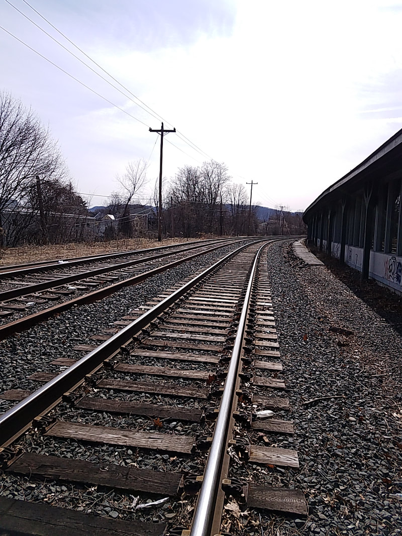
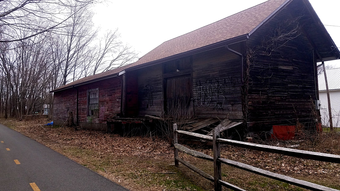
The building labeled both "New Union Station" and "BM Pass. Station" is still there. It is called Union Station and now houses a few restaurants. Amtrak rerouted their Vermonter train in 2016 to stop in Northampton (instead of Amherst). A small outside platform was built instead of using the existing building for this service which exists where the "RR Office" was in 1895. The first photo below shows the current ROW and old platform of Union Station.
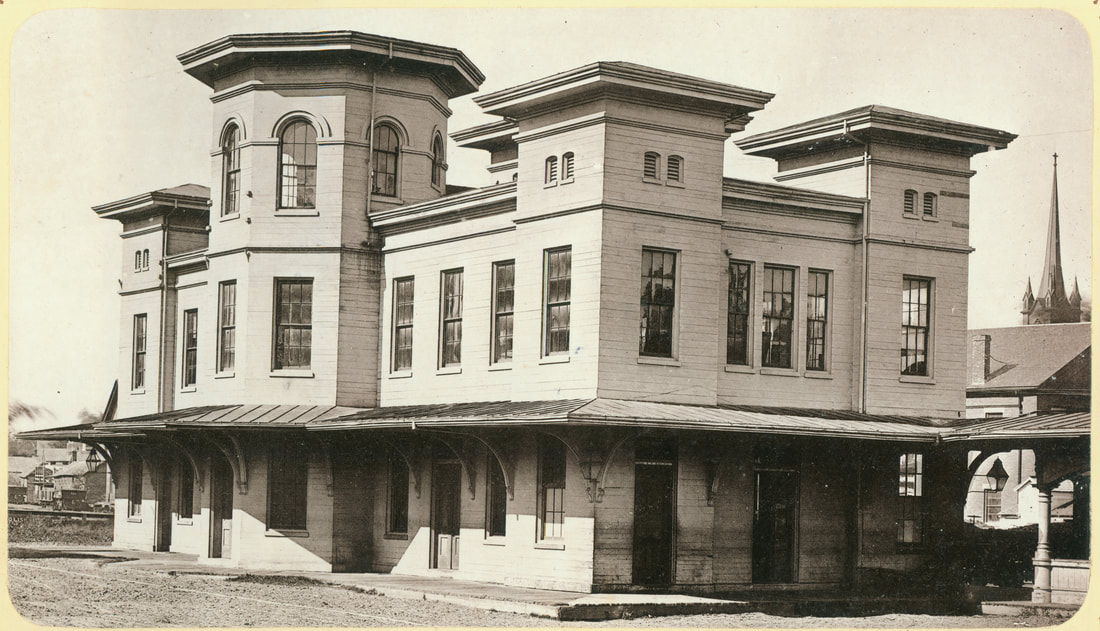
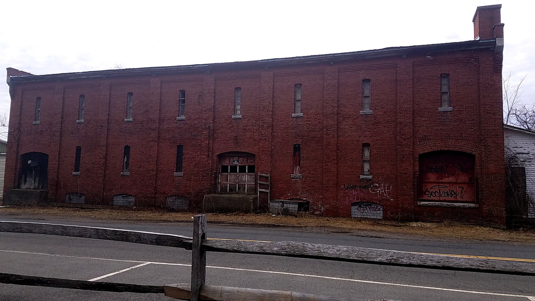
The second photo below shows the NYNH&H Pass. Station, as depicted on the 1895 map. The photo comes from Forbes Library. Unfortunately the station is no longer there.
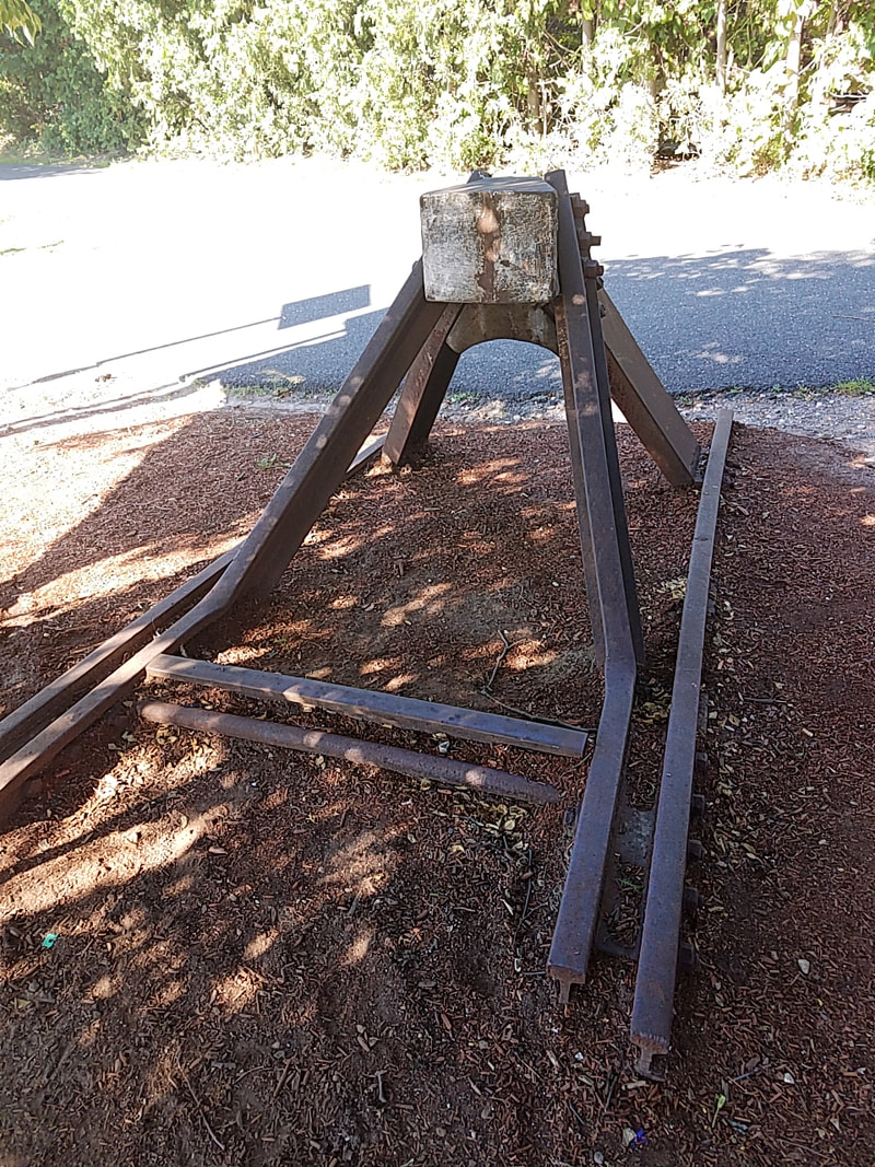
The third photo is an old buffer that now sits outside Union Station. It's probably from one of the spurs during the height of the railroad industry in town.
I would also like to point out the trolley lines running through the streets labeled "Electric Railroad". I cannot find a map dated later than this one, but I know that the lines were extended and eventually ran into Hadley (east), as well as Eastampton (south-west).
The building labeled both "New Union Station" and "BM Pass. Station" is still there. It is called Union Station and now houses a few restaurants. Amtrak rerouted their Vermonter train in 2016 to stop in Northampton (instead of Amherst). A small outside platform was built instead of using the existing building for this service which exists where the "RR Office" was in 1895. The first photo below shows the current ROW and old platform of Union Station.
The second photo below shows the NYNH&H Pass. Station, as depicted on the 1895 map. The photo comes from Forbes Library. Unfortunately the station is no longer there.
The third photo is an old buffer that now sits outside Union Station. It's probably from one of the spurs during the height of the railroad industry in town.
I would also like to point out the trolley lines running through the streets labeled "Electric Railroad". I cannot find a map dated later than this one, but I know that the lines were extended and eventually ran into Hadley (east), as well as Eastampton (south-west).
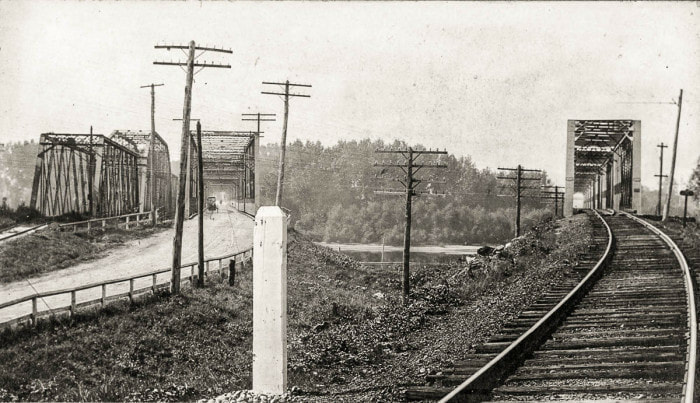
Just across the Connecticut River is Hadley, my home town. Based on the 1920 Boston and Maine Southern Division employees' timetable, there were two railroad stops in Hadley. These photos below were all taken in Hadley between the river and the Hadley Depot. The East Hadley stop is a larger building and water tower which are both re-purposed. They are less than 2 miles apart. Hadley stations were closed by 1955.
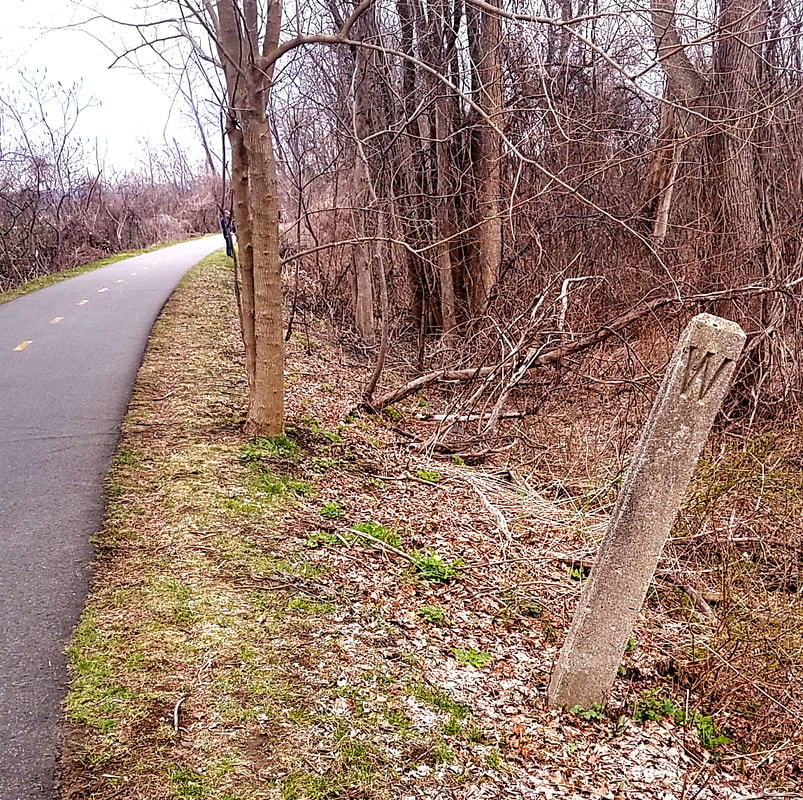
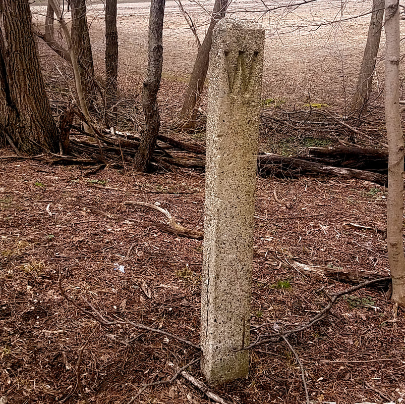
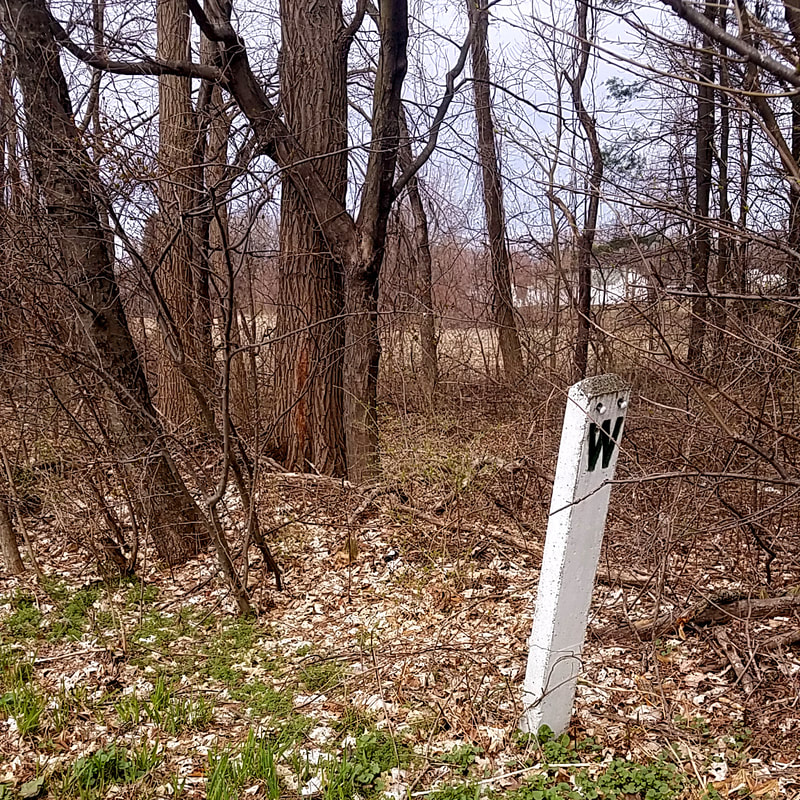
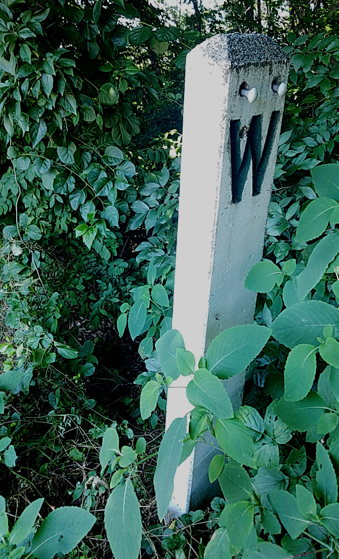
The ROW in Hadley is now a part of the Mass Central Rail Trail - Norwottuck Branch. The trail runs right past all of these locations and over the right-most bridge in photo one below. If you look carefully on a walk, you can still find old railroad ties, spikes, and pins on the edges of the path. All of these whistle posts are easily found walking along.
The ROW in Hadley is now a part of the Mass Central Rail Trail - Norwottuck Branch. The trail runs right past all of these locations and over the right-most bridge in photo one below. If you look carefully on a walk, you can still find old railroad ties, spikes, and pins on the edges of the path. All of these whistle posts are easily found walking along.
The Mass Central Rail Trail took the place of most of the railroad ROW in Northampton, Hadley, Amherst, and beyond. When the state planned the rail trail through northern Florence (a part of Northampton), however, they re-routed the path and avoided a section of original rail from the NYNHH, which is still there to this day. It took me about 10 minutes to walk the ROW very slowly as I explored, so it's probably about a third of a mile long.
The section can be seen on this map between Bridge Street and Northampton Street just to the west of the top corner of the Florence box.
The section can be seen on this map between Bridge Street and Northampton Street just to the west of the top corner of the Florence box.
|
|
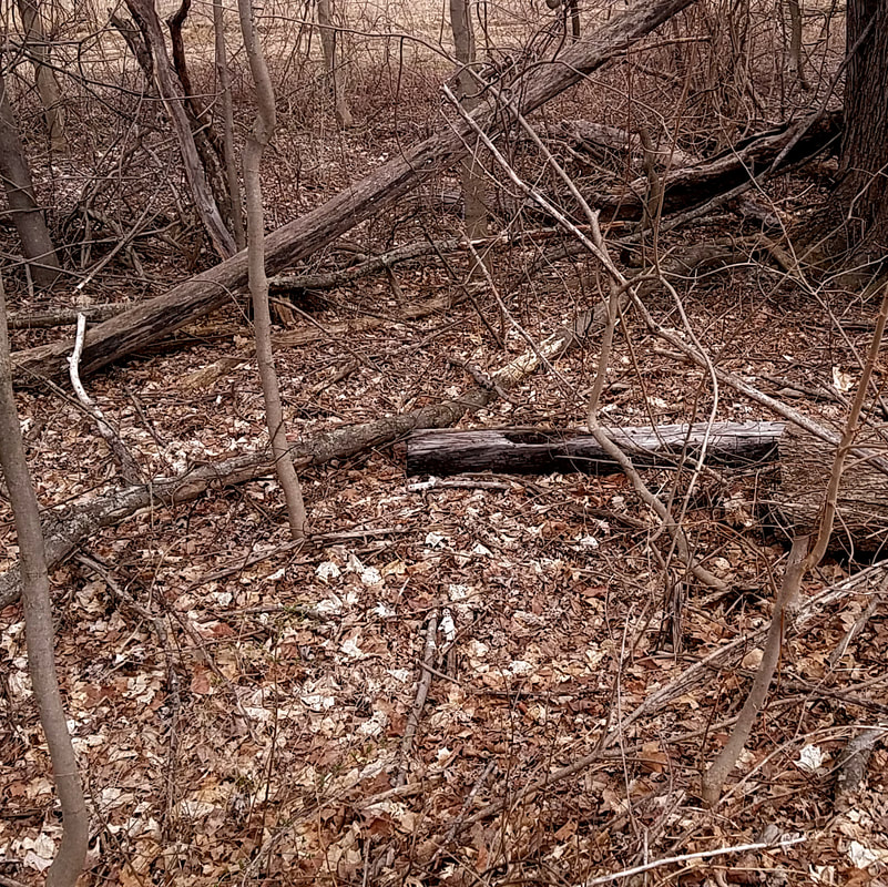
The first two photos are of the section where the rail was pulled up. There was nothing left there, not even ballast. Then, you can see that they'd pulled up some ties and thrown them to the side just before the rails begun. The father I walked, the more ballast, in-tact ties, and other debris from the time period (like the brick) I found. Clearly the line removal was done years ago, then abandoned.
It was suggested to me that an independent agency or individual pulled up the section that is gone as opposed to the railroad company or state having done it. I will have to see if I can find ownership records. Town maps list the electric company as current land owner. |
Header: Abandoned tracks in Northampton
